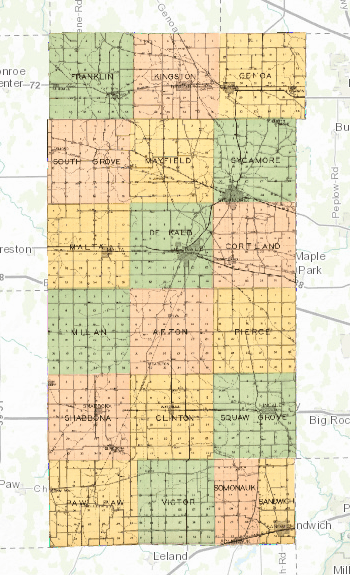
At the recent ALA library conference, I learned the basics of GIS from a Map and Geospatial information Librarian from the University of Minnesota. I was so excited to try it out for myself, using some historic maps related to my family’s history! I tested it out by making this composite map of DeKalb County. All of the maps that I used to create this map were from the 1929 Atlas and plat book of De Kalb County, Illinois : compiled from surveys and the public records of De Kalb County, Illinois, digitized by the Library of Congress. (See the whole atlas here!)
I started with the county map, matching up points on the county map with points on a present-day digital map using MapWarper. Then, I did the same thing for all the townships and main towns and villages in the county. I linked them together using ArcGIS. The result is a complete snapshot of 1929 DeKalb County! The finished map is best viewed in the web app here. Zoom out to see the whole county, and zoom in a little to see the individual townships and see the property owners in the country. Zoom in even further into a town, and see all of the streets and city lots! You can look at the different layers (or parts) of the map, and adjust the transparency of each layer to view the present-day map underneath it.


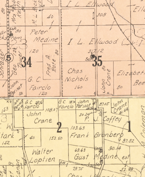
This map is cool, but why is a map like this useful? For me, it is a powerful tool for putting my ancestors within the context of their neighbors and their communities. For example, several of my ancestors lived on the edge of their townships, such as Gustaf Medine in northeast Mayfield township, and Charles Drake on the west side of Genoa township. This map quickly allows me to view their communities and their neighbors. A quick glance can tell me that although they lived in different townships, Gustaf lived very close to his brother Peter (see the image on the right). By using the slider to make the historic map more transparent, I can also compare it to present-day roads and landmarks, and quickly determine how the property has changed over the years. Combining historic maps with GIS technology can definitely produce some wonderful local history resources! Please explore my 1929 DeKalb County map and let me know what you think!

2 thoughts on “Snapshot of 1929 DeKalb County”